PLACE: Vikeså, Norway AREA: ca 160 daa YEAR: 2021-22 CLIENT: Bjerkreim Municipality TYPE: Urban planning, feasibility study STATUS: Feasibility study delivered TEAM: Audun Hellemo/Kristin Hilde, KAP, ATSITE, Multiconsult RENDER: Sanders Studios, London PUBLISHED: Norske Arkitektkonkurranser/NAK no 544 – link
RATING
SCALE (small>large)
STATUS (idea>built)
COMMERCIAL ($>$$$)
The new route for the improved E39 highway connecting Stavanger to Egersund and Kristiansand will have a big impact on the small towns along the road. With this as a starting point for the municipal plan, the feasibility study looks at how green energy, new mobility, tourism, local industry and challenges caused by climate change and rising water levels can be brought together in new, sustainable placemaking strategies for the future. At the centre of the study is the understanding of the regional role of Vikeså, the attraction of the surrounding landscape and the inherent social resources.
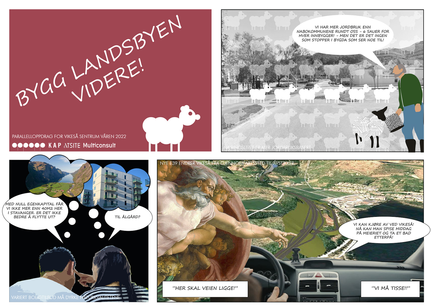
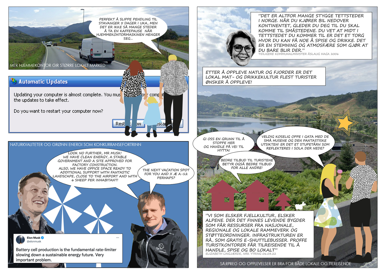
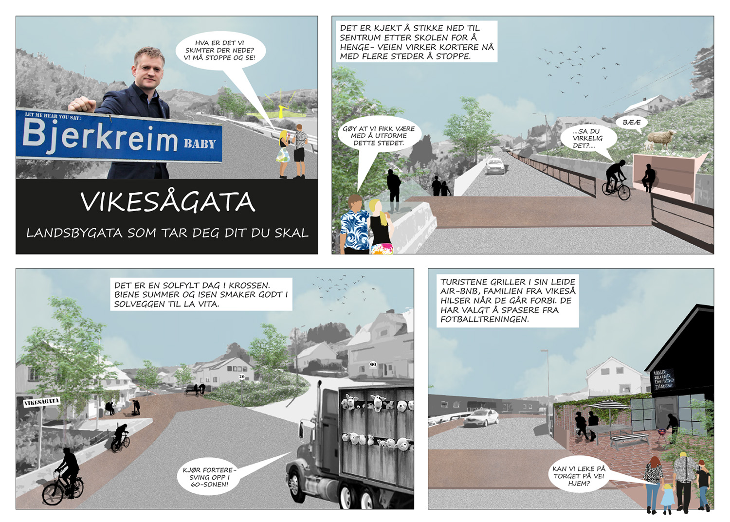
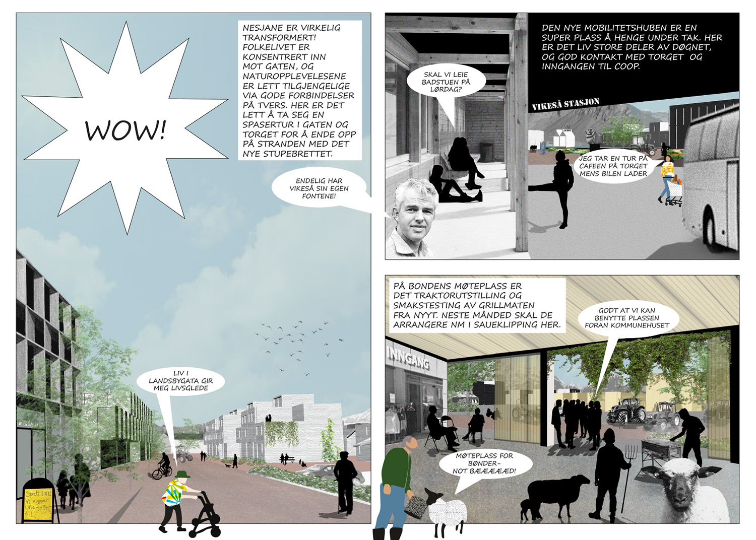
The feasibility study has a comprehensive research chapter, looking at Vikeså’s regional position in relation to other cities along the E39 highway connecting the regional capital Stavanger in north to Egersund and Kristiansand in south. By comparing data, local policies and identity markers, a thorough understanding of Vikeså’s potential is established. The findings are illustrated as a comic highlighting the research issues.
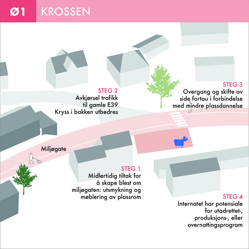
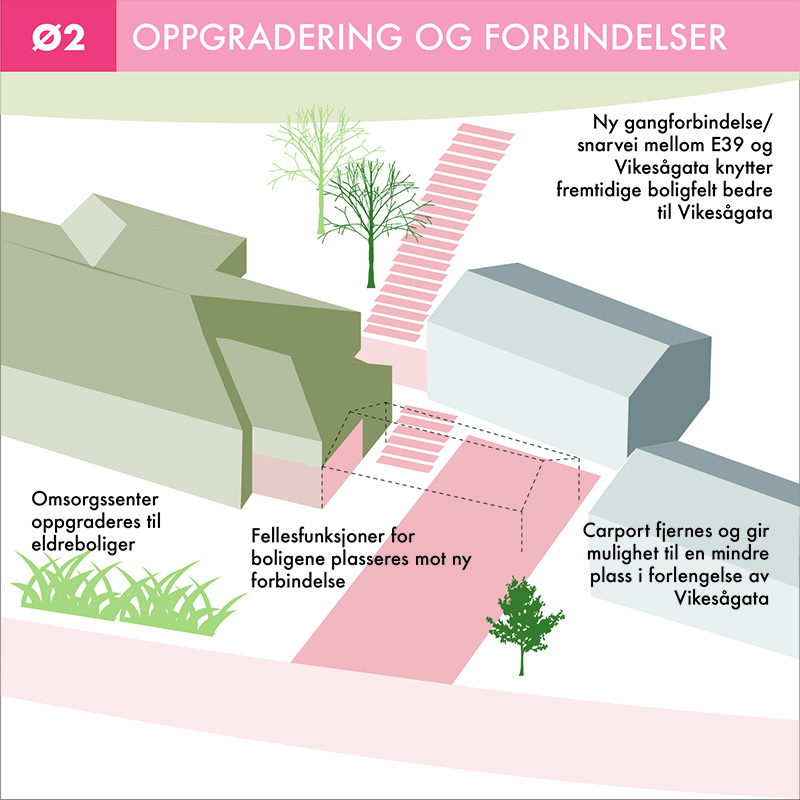
By focusing on the spatial village qualities already evident in Vikeså, the new development strategy should emphasize these and use the main road to better connect the different user groups by adding program and enhancing the street experience.
A new street hierarchy caused by the improved highway
The main street connecting the important events
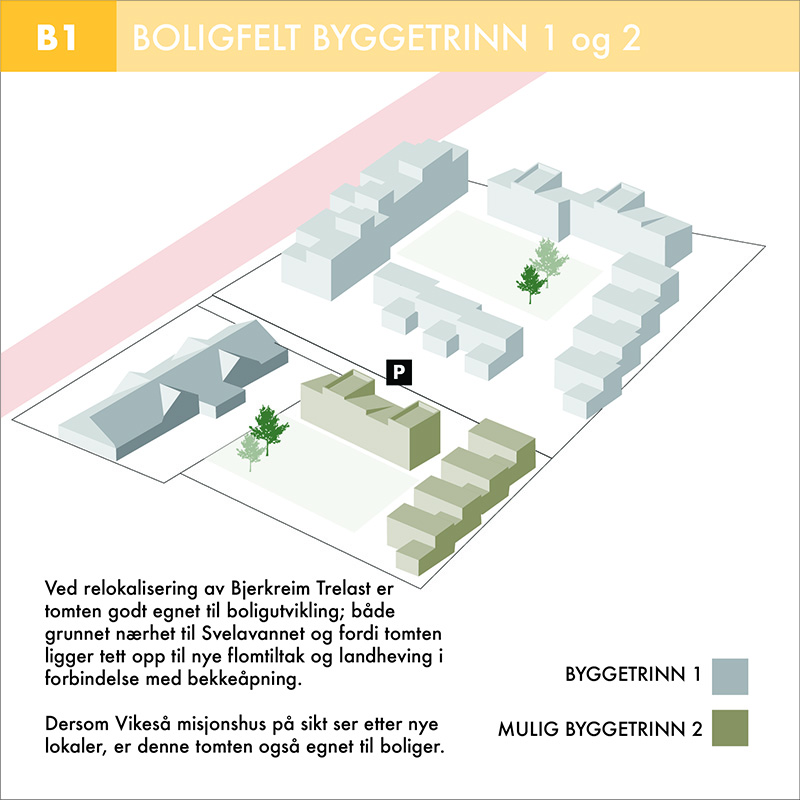
Municipal sites strategically positioned for maximum impact
Flooding measures integrated in the landscape strategy
The four layers of the plan: The main street, the green qualities, the meeting places and the building structure.
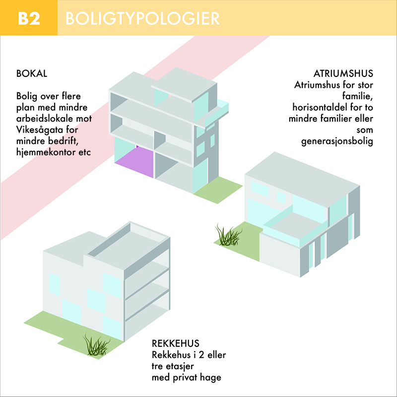
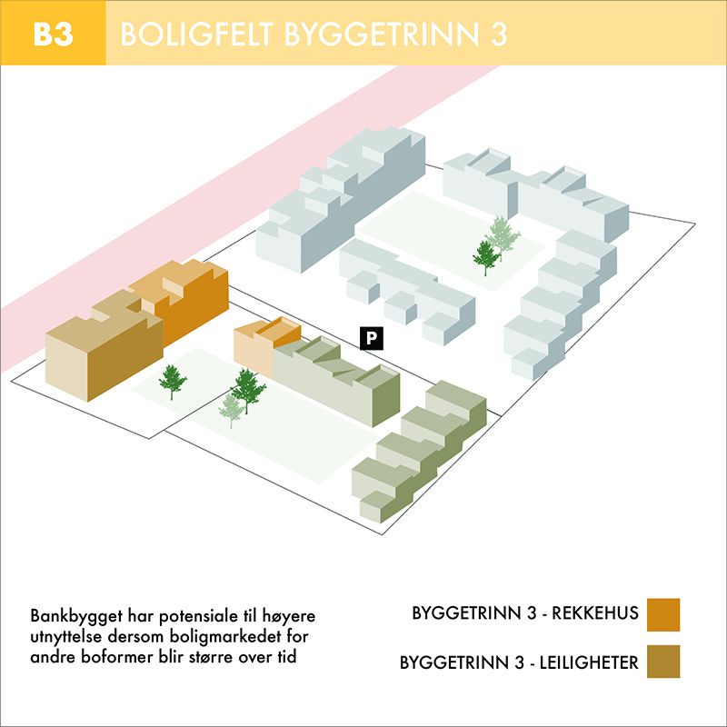
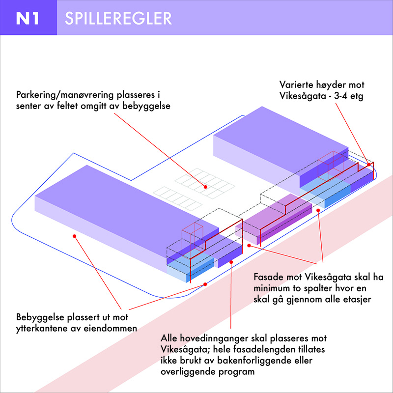
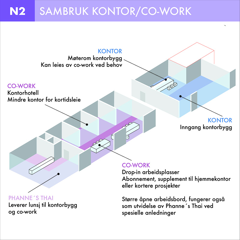
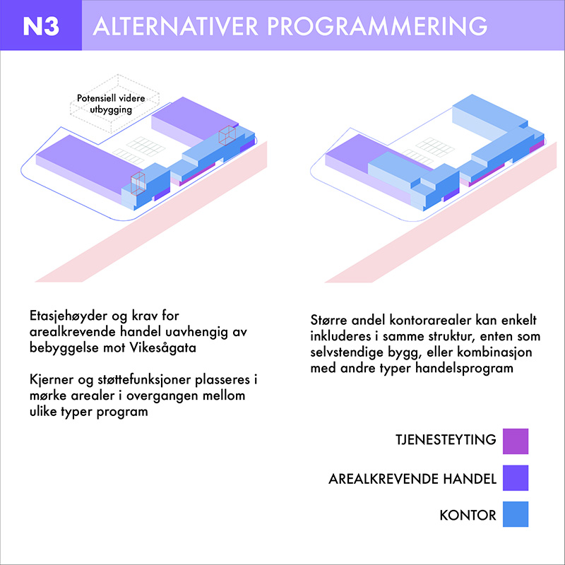
For each area in the plan, a number of possibilities are presented – either as small projects, rules for development or examples of use. The projects work as a toolbox for future development, where each area can be developed regardless of the other areas in the plan.
The timeline outlines a possible scenario where the different projects gradually transform Vikeså to a renewed village. The flexibility in the plan does not require a specific order, but offers tools that can be adapted to a variety of different future scenarios.
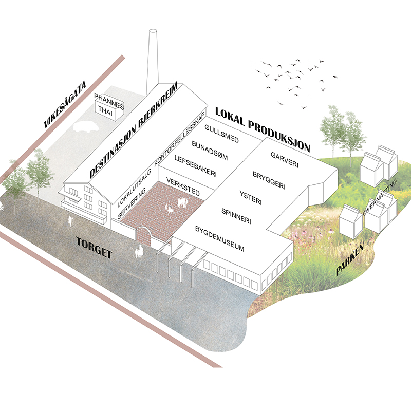
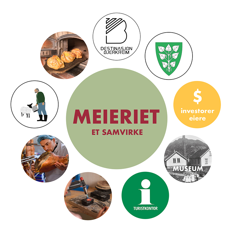
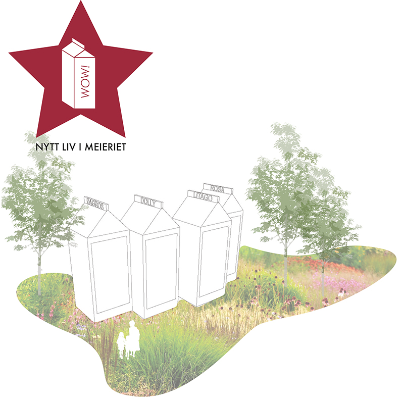
As one of the few historic buildings in Vikeså, the old dairy has potential of becoming the new meeting place; a strategic point connecting the old and the new developments, infrastructure, visitors and inhabitants, showcasing the local industry, produce and landscape with a new public space that brings it all together.