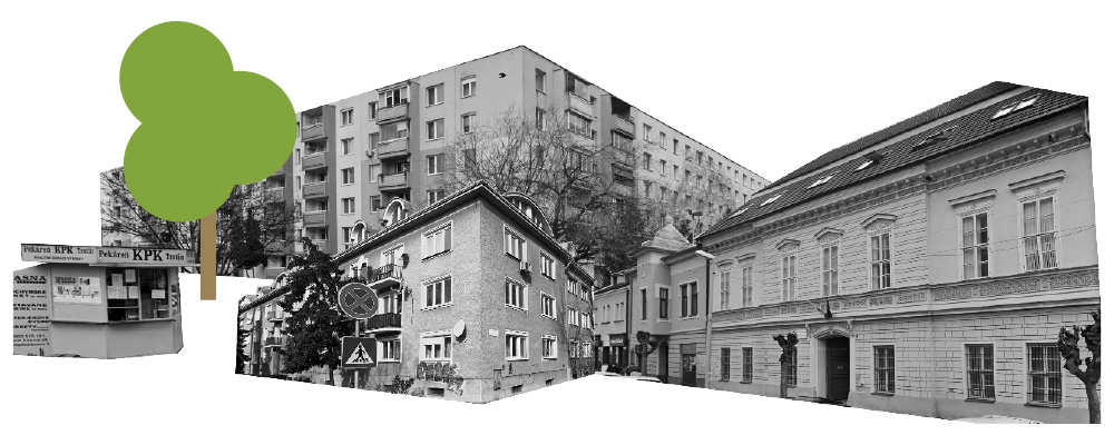
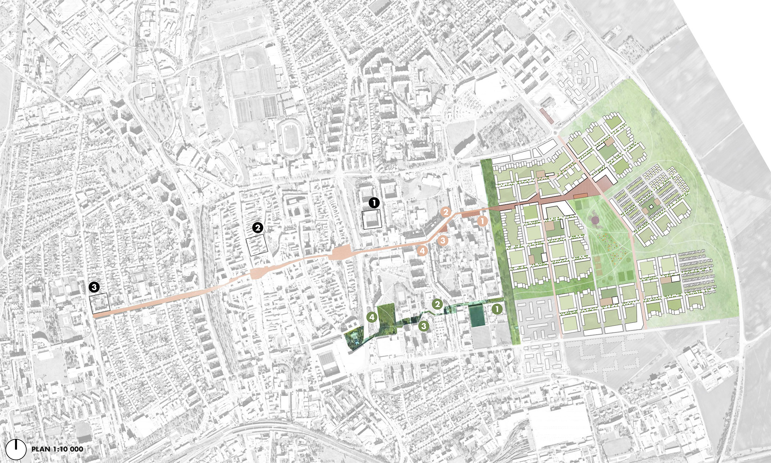
PLACE: Trnava, Slovakia AREA: 135 ha YEAR: 2023 CLIENT: Mesto Trnava TYPE: Urban planning STATUS: Open international competition, proposal – rated top 50% of all proposals TEAM: Audun Hellemo/Kristin Hilde
RATING
SCALE (small>large)
STATUS (idea>built)
COMMERCIAL ($>$$$)
The new quarter is closing the gap in the urban structure of Trnava; it should complete the dense city with an urban development that both learns from the city it completes as well as improves the urban condition of its neighbouring areas. The new Quarter will be a dense urban environment with the experiential qualities of traditional European cities, and at the same time provide a simple life close to nature where everything you need is close by. A fine-tuned network of parks, streets, paths and roads makes it possible to easily move around on foot with different qualities and experiences every time.
Everyday is where your heart is! <3
The proposed masterplan establishes several links to Trnava, both physical – by emphasizing connections to the city centre, and thus the city as a whole – and in scale and atmosphere by building on the best examples of urbanity in Trnava today and develop these further in a green, sustainable city for the future. The streets are celebrated as urban spaces, and the development is divided in smaller neighborhoods with individual identities within the masterplan as a whole. In this way, a lively and diverse city can grow over time keeping the urban qualities missing in recent developments.
STRATEGY
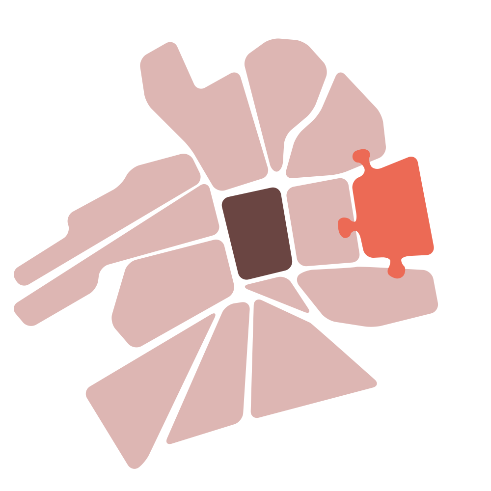
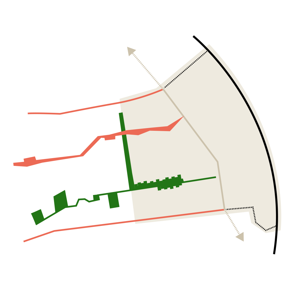
THE QUARTER AND THE CITY
Mestská štvrť
Challenges:
– Disconnected from the city centre
– Lack of urban character in Družba makes the distance feel even greater
– Density does not always equal urban quality
– Stamp developments without regard for the whole
New quarter as an integrated part of the city
– Establish and improve links to the city centre
– Relate new structure to size, density and variety of the rest of the city
– Create destinations attractive for all citizens of Tnvara
Limit the growth – define the city’s expansion
– Define a green buffer that limits future growth
– Establish a network of green/blue connections
– Densify over time inside the area
– Develop strategies to increase density in neighbouring areas
Develop neighborhood by neighborhood
– Define neighborhoods of a manageable size
– Create a network of public spaces that relate both to the neighborhood as well as the urban scale
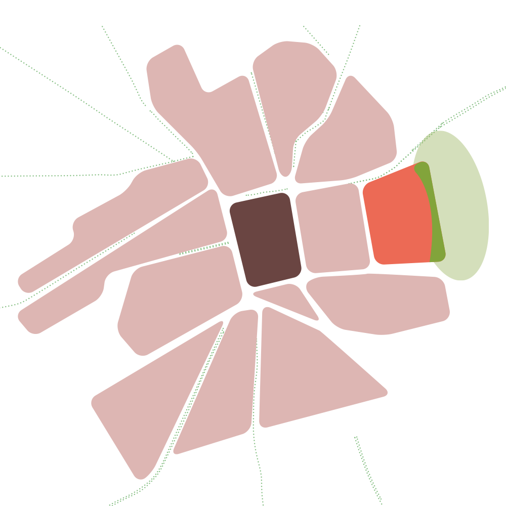
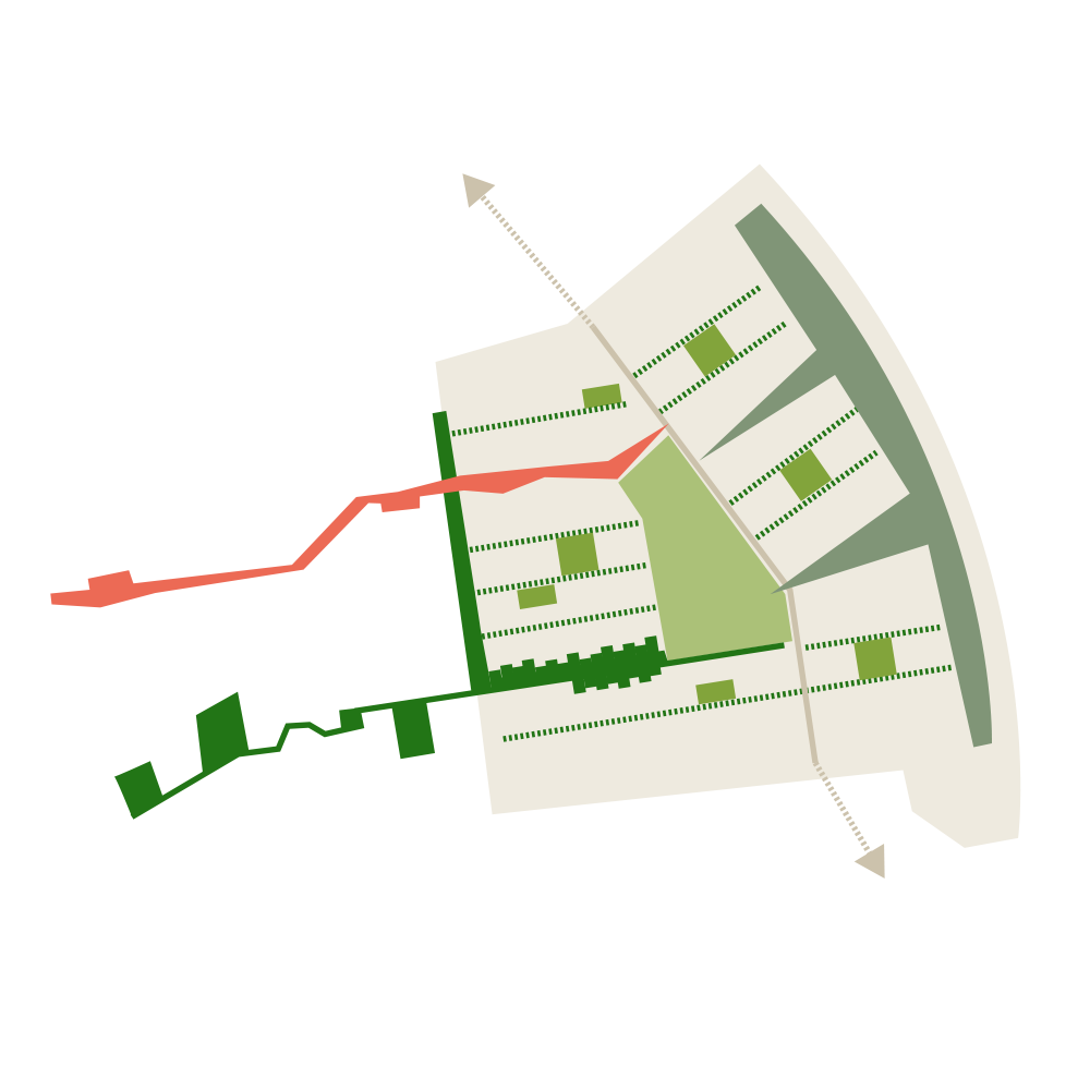
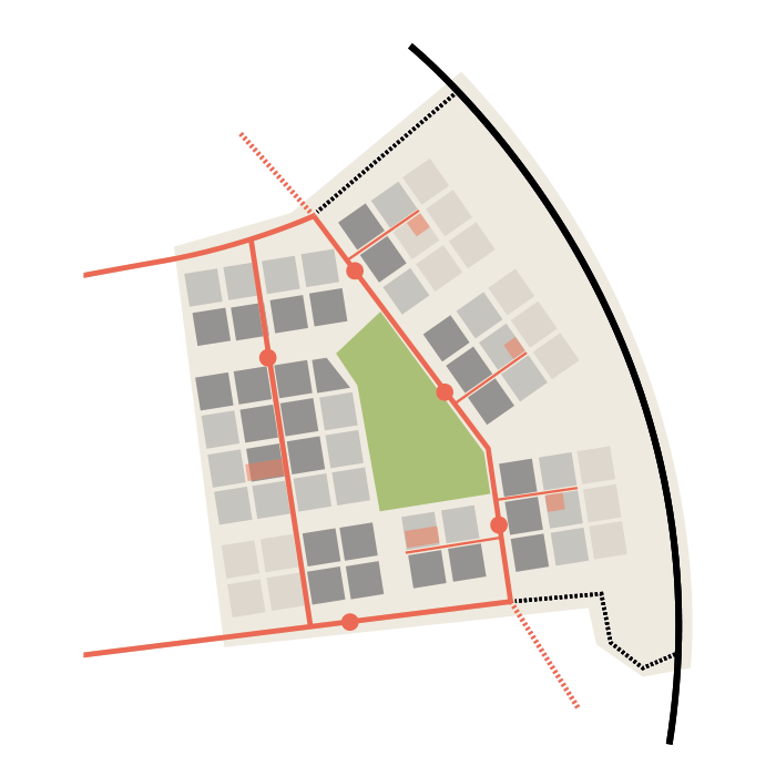
THE QUARTER
Mestská štvrť
Challenges:
– Ensure urban quality in long term developments with great uncertainties
– How to create variety in a large, flat area with few spatial qualities?
– Lack of large, green parks in the city
Connections define neighborhoods
– Programmatic connections divide the site and define neighborhoods
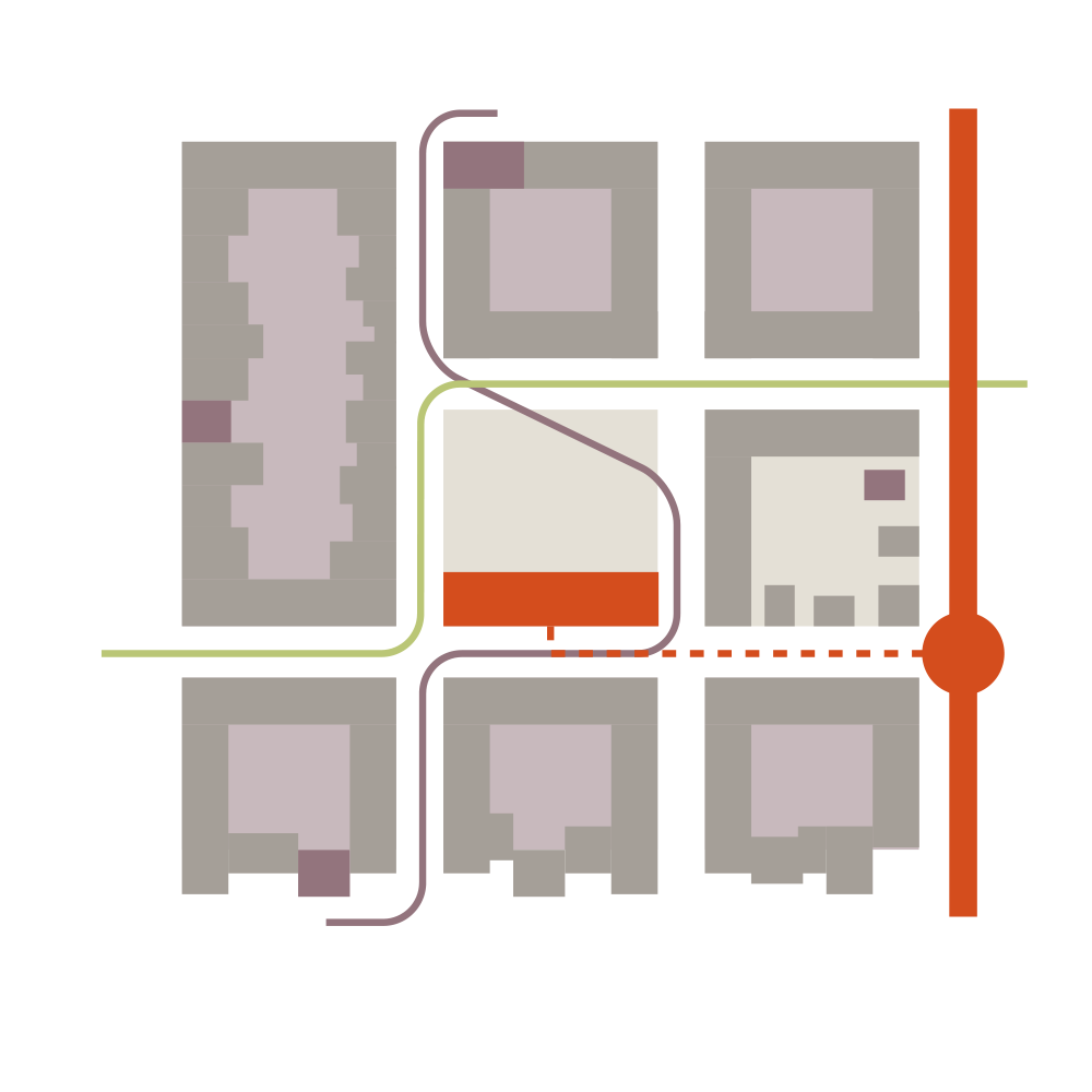
– Two links to the city centre are strengthened: an urban link with commercial program and a green link with natural experiences
– Improve links and connection points between old and new development
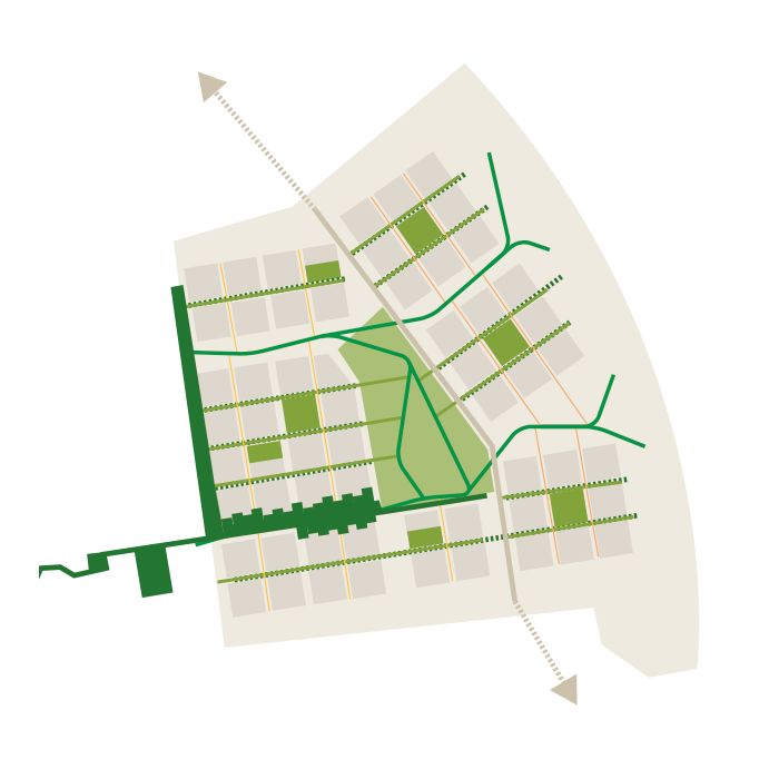
A continuos green structure
– A central park easy accessible for everyone
– The green buffer extends towards the park and provides natural qualities for each neighborhood
– Network of neighborhood parks
– Green connections and green streets
– Designated streets for public transport and car access, smaller streets for green transport and experiences
Learn from the dense city
– Robust structure based on the scale of the existing city
– Blocks of 100m x 100m correspond to the different types in the city today, can accomodate every urban program
– Regular and adaptable to the urban qualities surronding each neighborhood
– Can develop and be adjusted over time, while maintaining its spatial and urban qualities
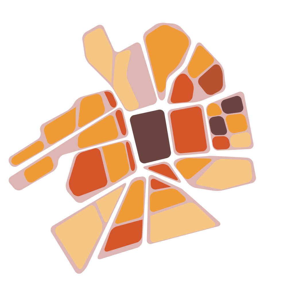
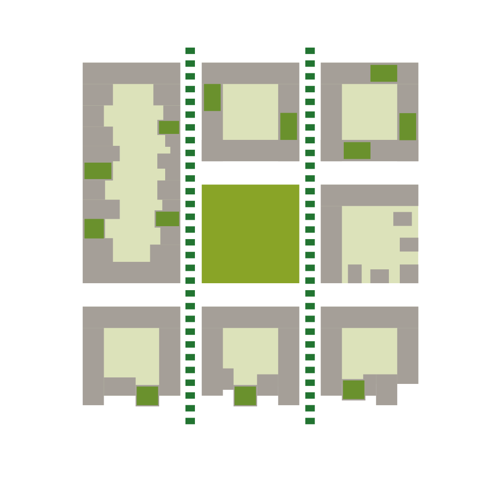
THE NEIGHBOURHOOD IN THE QUARTER
Susedstvo v mestských štvrtach
Challenges:
– Establish rules for development that can accomodate a large variety of program
– Allow for playfulness, variety and shortcuts within a fixed and rational structure
Each block responds to its location
– Typologies within the masterplan continue and reinterpret the typologies from the city
– Each neighbourhood should have a variety of typologies, density and program
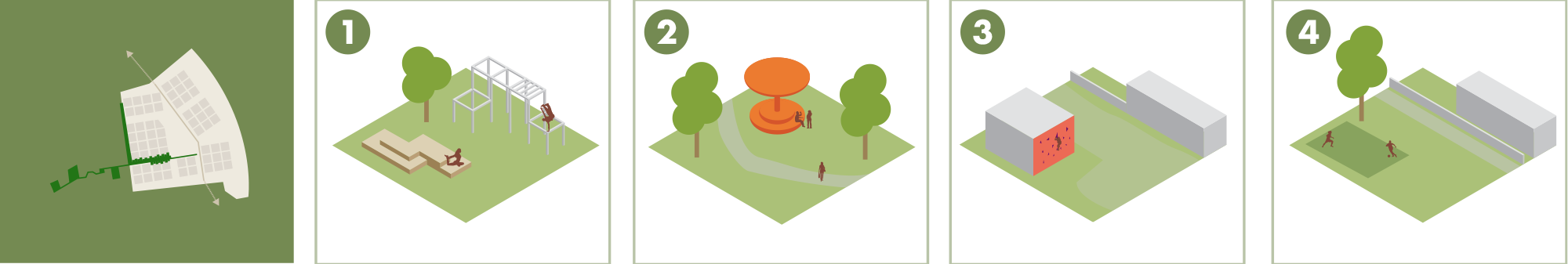
The everyday green urban life
– Every neighborhood should have a neighborhood park and have access to a green connection for pedestrians/bicyclists
– Size of park depends on density of the neighborhood
– Hierarchy of green spaces; public, semi-public and private
– Nature integrated in streets, on roofs, on facades
The fine grain of the village, the density of the city
-Each neighborhood should have spaces to meet and engage, both outdoors and indoors
– Common functions include spaces for urban gardening, playgrounds, mobility hubs and workshops
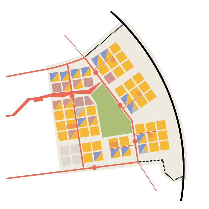
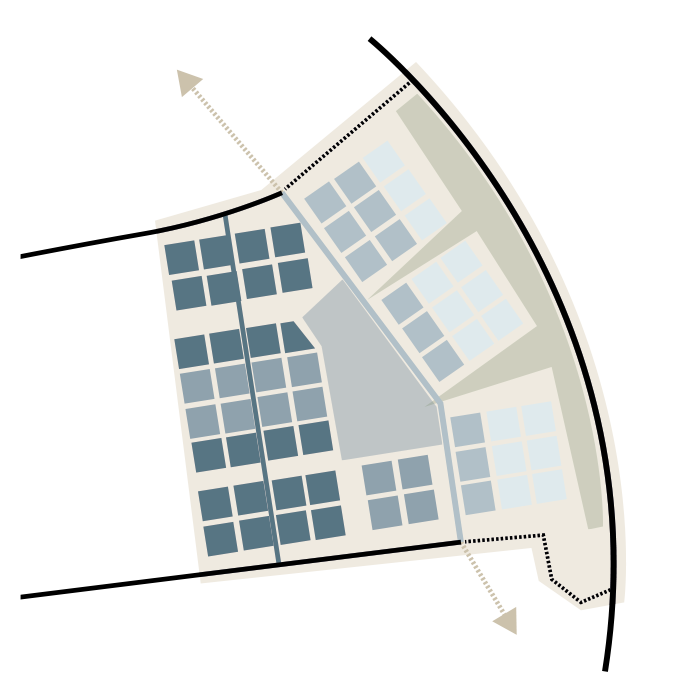
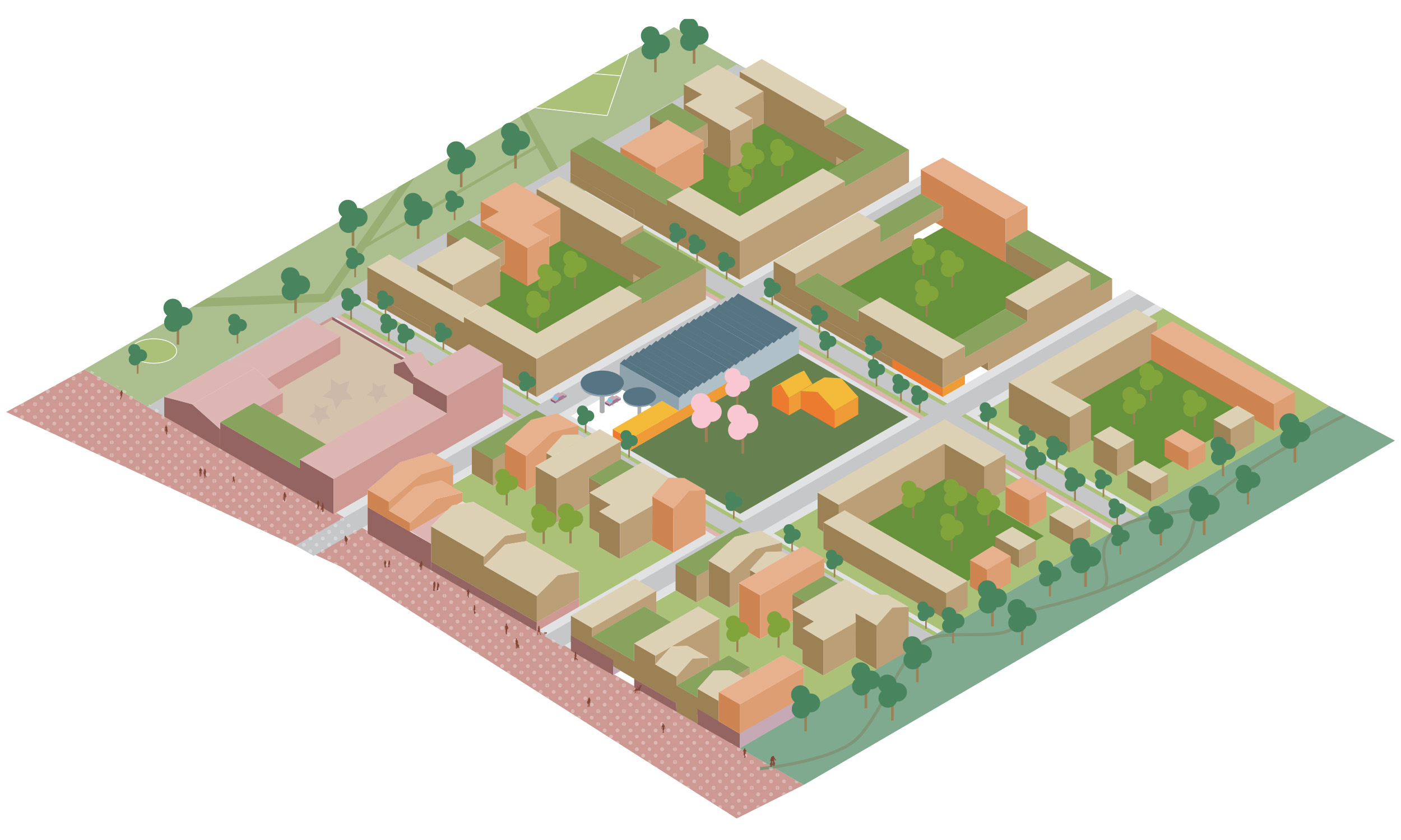
A NEW PLAN
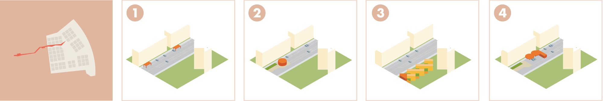
GREEN MOBILITY
All new building areas have easy access to green connections with to the rest of the city
The connections offer different experiences and give priority to pedestrians and cyclists
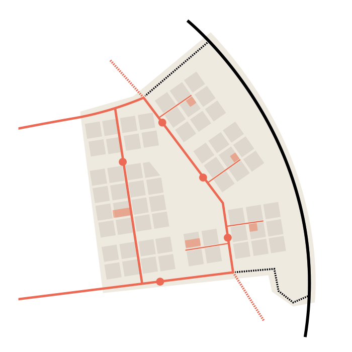
TRAFFIC
cars and public transport along main route through the area
stops for public transport are located at each neighbourhood with mobility point close by for charging/car-share etc
DENSITY
Each neighbourhood should have a variety of density due to various typologies
Higher density along the main roads with gradually decreasing towards the green structure
PROGRAM
Each neighbourhood should have a mix of functions
Commercial program primarily focused along urban connection with commercial ground floors
Office primarily focused along the north and south borders
PHASES
Development starts along the two main connections to the city centre and road connecting north-south
Gradually filling in the areas in between and surrounding the park
Outer plots filled in and densified over time
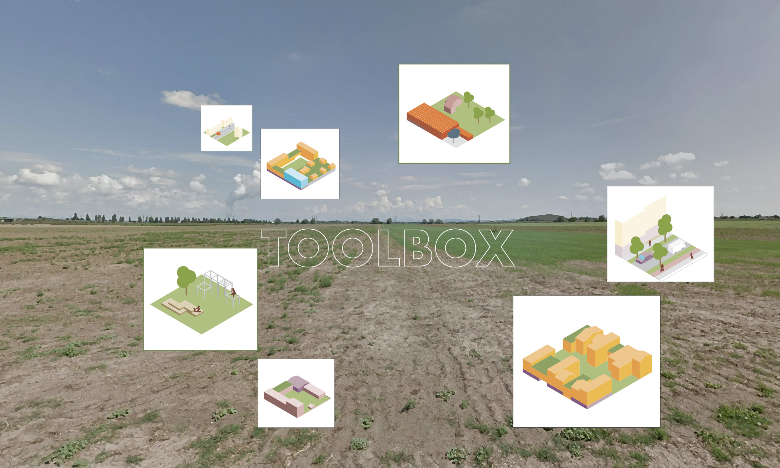
Within the framework outlined above, the plan provides a toolbox of typologies and interventions that can be adjusted and adapted as planning of the area progesses. Some are rules for new construction based on the most urban examples present in Trnava today, some are tools to improve the connections to the city centre outside of the planning area. Thus, the strategy improves the connections both inside and outside the site.
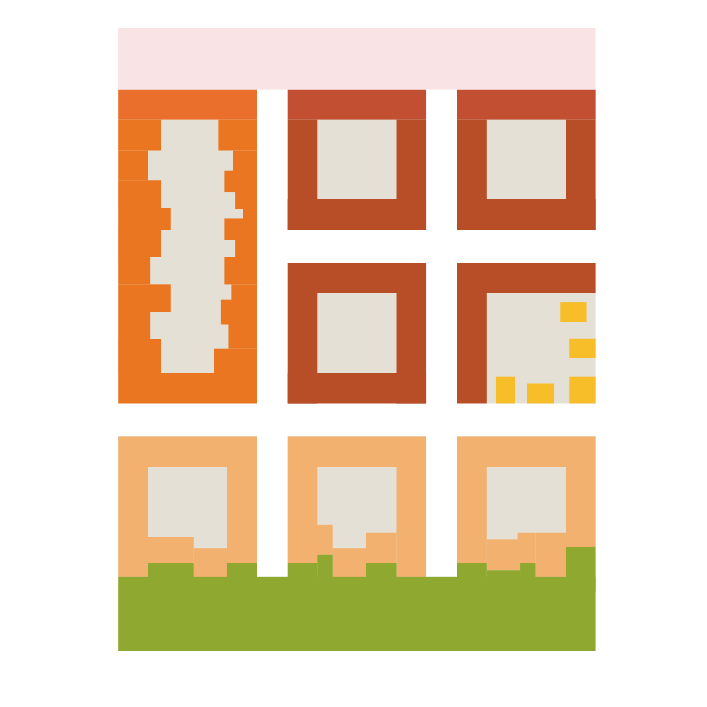
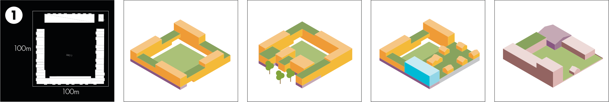
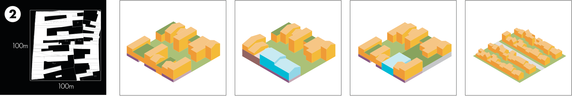
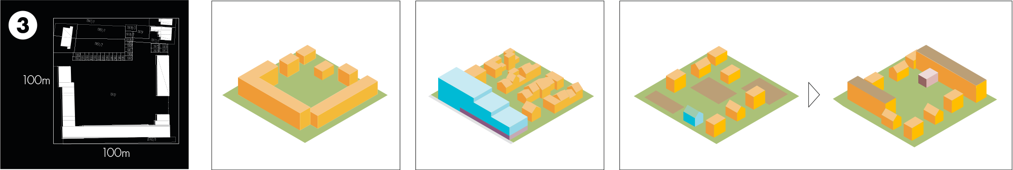
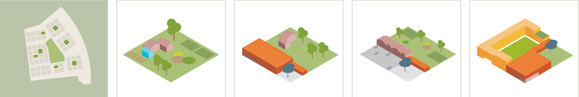
TYPOLOGIES
70s PERIMETER BLOCK
Varying height with public ground floor
Housing adjusted to green structure
Radical functional mix housing/office/industry
School with shared public functions
OLD CITY CENTRE
High-Density housing
Mixed-use office/housing
Mixed-use housing/office/industry
Medium-Density housing
COMBINED BLOCK –DETACHED HOUSE
High-Density housing
Mixed-use office/housing
Low density housing/agriculture with potential for densification over time